The Cumberland County Registry of Deeds is a vast resource for property transactions, family links, and so much more.
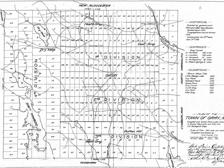
This plan of the Town of Gray, ME was compiled and drawn from a plan belonging to Samuel Weymouth, and from the U.S. Geological Map
Scale of Plan 100 rods per inch Compiled and drawn by H.W. Foster CE Cumberland Mills, ME – May 5th 1906; Retraced March 1932; Filed 16 Sept 1938